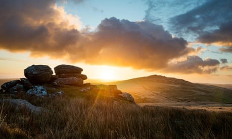
Far from urban areas and highways, Louis de Bernières’ new novel’s setting is perfect for eerie hikes and a true break from the 21st century
Instead of relying on GPS, the ideal way to navigate Cornwall’s Bodmin Moor, a rugged expanse of granite, is to acquire a traditional Ordnance Survey map. This is precisely what author Louis de Bernières opted for when he was surveying the backdrop for his latest work, “Light Over Liskeard,” a “heartwarming” dystopian fantasy. In this tale, the protagonist, a quantum cryptographer named Q, seeks sanctuary and self-reliance in a remote farmhouse on the moor while anticipating the decline of civilization.
The acclaimed author of “Captain Corelli’s Mandolin” selected Bodmin Moor for a distinct reason: it’s one of the most remote locations from any densely populated areas. While the moor is surrounded by small towns, including Liskeard, and dotted with small, clustered villages, it lacks nearby cities and convenient highways. Reliable phone reception is also sparse, making the idea of living off-grid a tangible reality amidst the rugged outcrops of the High Moor. In this relatively unexplored part of Cornwall, solitude can be easily attained.
I discovered it to be desolate and enigmatic, a realm filled with specters and remnants. It felt akin to being in a foreign land
During a recent visit to my native moorland area (as I was born in Liskeard), I hiked to the summit of the abandoned Leskernick Hill. Amidst sheep, gorse, and scattered traces of age-old hut circles, I observed as clouds grew gloomier above the rugged peak of Brown Willy (Cornwall’s highest elevation at 419 meters). A brief, intense rain shower followed, and then a rainbow appeared. I found myself far removed from the Cornwall that most people typically envision.
Similar to many of the county’s visitors, Louis de Bernières initially encountered Bodmin Moor through glimpses of its enchanting scenery from the A30 highway. However, a few years ago, he had the opportunity to participate in the Bodmin Moor Poetry Festival. He shared, “I took some walks around the moor. I found it to be a desolate and enigmatic place, filled with the aura of ghosts and the ruins of abandoned mines and quarries. It had a haunting, atmospheric, and distinctly peculiar quality, making it an almost foreign setting for a story.”
Bodmin Moor, recognized as an Area of Outstanding Natural Beauty, is steeped in its own rich narratives. The landscape is adorned with tumuli, Bronze Age standing stones, cairns, and quoits (Cornish for megalithic tombs). On the rugged granite tors, remnants of ancient settlements coexist with the vestiges of 19th-century engine houses and disused mineral railways, chronicling the region’s historical tin and copper mining booms (which is part of the Cornish Mining World Heritage Site). The moor is also the origin of several rivers, including the Looe, Lynher, Fowey, and Camel.
Legend has it that the stack of granite slabs, commonly known as the Cheesewring, is attributed to the efforts of giants. In the nearby area of Minions, the three concentric rings of standing stones referred to as the Hurlers, often considered the finest examples of ceremonial circles in the southwest by English Heritage, are said to be men who were turned into stone for playing the game on a Sunday.
De Bernières was particularly captivated by Bodmin Moor’s associations with King Arthur. This is why one of his characters takes the form of an “anachronistic Arthurian knight who’s waiting for the return of the king.” Readers will encounter Bedwyr Bedryant on horseback along the shores of Dozmary Pool, a tranquil and somewhat eerie lake. According to legend, it is in the depths of this lake that Arthur’s sword Excalibur is said to rest.
Following a brief, intense rain shower, a rainbow appeared, emphasizing how far removed I was from the Cornwall that’s typically imagined
Maybe not, or at least not in a similar manner. The moor’s exquisite allure lies in its unspoiled natural beauty. Those who hold an affection for this location welcome its austere vistas and capricious climate, referred to in meteorological terms as “peninsular convergence.” Caradon Hill, which overlooks Liskeard, claims the title of being the wettest spot in Cornwall. Traversing soggy heathlands in sturdy boots and waterproof gear will never quite match the allure of a sunny beach on a Greek island. The novel doesn’t present any readily visible paths akin to “Light Over Liskeard.”
The book incorporates various entirely fictional elements, such as marinated mouse kebabs, aurochs, and tame lynxes. Nevertheless, it also references a few genuine locations. Leskernick Hill and Bray Down, situated in the northern region of High Moor, can be glimpsed from a distance. The narrative predominantly centers around the southern area near Brown Gelly or Stowe’s Hill, which is home to Cheesewring Quarry, along with the villages of St Neot, St Cleer, and Upton Cross. In this landscape, rugged granite tors seamlessly transition into grassy heathlands and cascade into deep valleys, lush with temperate rainforests. Oak trees are adorned with velvety moss and draped with lichen. Sheep and shaggy brown cows leisurely roam along the roadside, only contained by cattle grids and low dry stone walls.
Liskeard, one of the four historic mining towns that encircle the moors (alongside Callington, Bodmin, and Launceston), holds a place in the novel because, as the author elucidates, “I realized that, when examining my OS map, if you ascended the tor where I’ve situated my characters, Liskeard is the only sizable town you’d be able to see.


